Back
Next Page- Wood Carvings
Home
Contact Us
Our Hobbies
'The Fishing Hole'    


Walleye Fishing Forecast for 2000
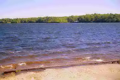
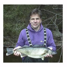
Walleye fishing was very good for legal length walleye (over 15 inches) in 1999 and is expected to be even better in 2000. DEP Fisheries Division sampling indicates that walleye are moving into Candlewood Lake from Squantz Pond, several fish weighing between 3 to 5 pounds were sampled by DEP fisheries crew. Walleye have great potential to take advantage of offshore schooling minnows and perch and provide great fishing for anglers year round including ice fishing. "The maximum weight for walleyes improves every year", said Jerry Leonard, Walleye Project Leader. "We’ve seen fish over nine pounds in Squantz Pond and one 11 pounder from Gardner Lake." The Fisheries Division has sampled walleye over 16 inches in Lake Saltonstall and Saugatuck Reservoir which means that active fisheries can begin in those lakes in 2000.
Project Leader Jerry Leonard shows off a Connecticut walleye from Gardner Lake in Salem.

Fishing for Walleye
Walleye may be fished in deep water, usually over 15 feet, during the day but are more aggressive when found in shallower water from early evening to two hours after dawn. During their prime feeding times, walleye can be taken with live bait and by casting crankbaits; trolling weed bed edges and drop offs with fish imitations; and jigging drop offs and structure (15 to 30 feet deep).
The Future
DEP Fisheries Division is very optimistic about the potential of walleye and national walleye magazines are beginning to identify Connecticut lakes as walleye destinations.


Gardner Lake is located in the towns of Salem, Montville, and Bozrah in New London County, approximately 6 miles southwest of the city of Norwich.
The lake is natural in origin, but its area and depth have been increased by a dam at its outlet. The normal elevation of the lake is 382 feet above sea level. The surface area of the lake is 487 acres with a maximum depth of 42 feet.
Gardner Lake receives water from several intermittent streams and brooks including Whittle and Sucker Brooks. Drainage from the lake is to the north into Gardner Brook which flows into the Yantic River.  The lake has a watershed of 3,537 acres. The watershed is primarily wooded or wetland with some agriculture and urban development. A large wetland is located along the northern shore and remains undeveloped.

Hopemead State Park, located along the northeast shore, is the only other large undeveloped tract of shoreline on the lake. The remainder of the shoreline is highly developed with private residences and campgrounds. The island, located in the southeast area of the lake, is the site of Minnie Island State Park. There are no facilities at either Hopemead or Minnie Island State Park.

Access to the lake is provided by a state owned boat launch located on the southern shore of the lake. The launch can be reached from Norwich by taking Route 2 west to Route 354 south. The access road to the launch is off Route 354 just north of its intersection with Route 82. Facilities at the launch include a ramp with concrete pads, chemical toilets during boating season, and parking for approximately 50 cars with trailers.


Favorite fishing spots, stories and photos.
Gloucester, Mass.  Yankee Fishing Fleet-April 14, 2000
Bitmap Image Bitmap Image Bitmap Image
For More Photos & Fishing Trip Description:   April Cod Fishing Trip

State of Ct. Rules and regulations and State boat launch sites and Fishing areas.
http://dep.state.ct.us/index.htm

Fishing animation
CT.  Bureau Of Natural Resources (fishing Hunting) http://dep.state.ct.us/burnatr/index.htm


Next Page-WOOD CARVINGS
Previous Page
Home

                    Back to Top